001282-02: Austria-Hungary
1892
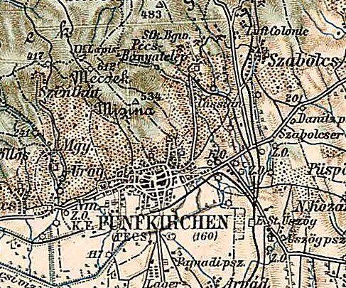
Excerpt from a map of the Third Military Mapping Survey of Austria-Hungary, probably published in 1910 although the map seems to be dated 1892. Shown is the vicinity of Fünfkirchen, Austria-Hungary (also known as Pécs). The town of Szabolcs (today known as Mecsekszabolcs) is to the northeast. Albert Pohl [00546] and Maria (Bittner) Pohl [00547] probably lived in or near Szabolcs, Hungary before emigrating to America in 1892 and 1893.
Source: Eötvös Loránd Tudományegyetem, Eötvös Loránd University, Department of Cartography and Geoinformatics (http://lazarus.elte.hu/ : downloaded 12 August 2011), Third Military Mapping Survey of Austria-Hungary (Map Index: http://lazarus.elte.hu/hun/digkonyv/topo/3felmeres.htm; Pécs: http://lazarus.elte.hu/hun/digkonyv/topo/200e/36-46.jpg).
Citation: Mike Voisin, iSeeAncestors (https://iSeeAncestors.com/tree/groups/public/media/sf-00007-05.php : revised June 12, 2023), Family Gallery.
Revised: June 12, 2023
Copyright © 2000-2023 Mike Voisin. All rights reserved.
