
001283-01: Hungary

2003
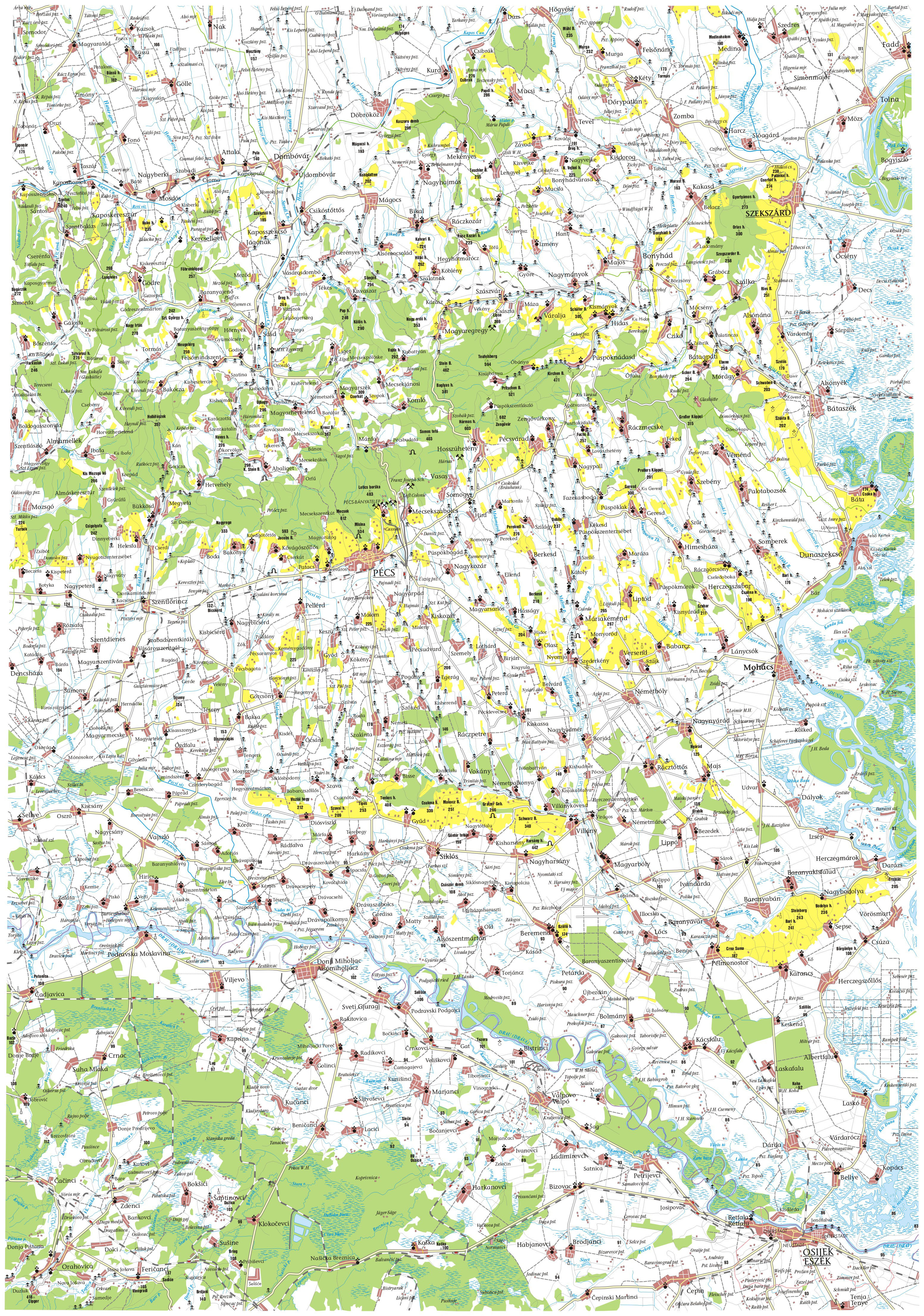
Excerpt of a map of Hungary, probably published in 2003. Shown is the vicinity of Pécs, Hungary (formerly also known as Fünfkirchen). The town of Mecsekszabolcs (formerly Szabolcs) is to the northeast. Coal mines are indicated with crossed-hammer symbols.
Source: Eötvös Loránd Tudományegyetem, Eötvös Loránd University, Department of Cartography and Geoinformatics (http://lazarus.elte.hu/ : downloaded 12 August 2011), Nemzeti Kulturális Örökség Minisztériuma [Ministry of Cultural Heritage] (Index: http://lazarus.elte.hu/hun/tantort/2003/palyazat/; Pécs: http://lazarus.elte.hu/hun/tantort/2003/palyazat/36-46_pecs.jpg).
Citation: Mike Voisin, iSeeAncestors (https://iSeeAncestors.com/tree/groups/public/media/sf-00007-06.php : revised June 12, 2023), Family Gallery.
Revised: June 12, 2023
Copyright © 2000-2023 Mike Voisin. All rights reserved.