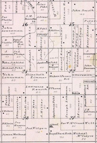
000825-01: 1896 Plat
1896
Plat of Westphalia Township, Clinton, Michigan, 1896, showing land owned by Gerhard Rademacher [00567] in Sections 15 and 22 (160 acres).
Source: Geo. A. Ogle and Company, Standard Atlas of Clinton County, Michigan: Including a Plat Book of the Villages, Cities and Townships of the County (Chicago, Illinois: Geo. A. Ogle and Company, 1896), Westphalia Township, micounty-2911305.0001.001-37; digital image, University of Michigan Digital Library, Michigan County Histories and Atlases (http://quod.lib.umich.edu/m/micounty/ : downloaded 3 December 2009.
Citation: Mike Voisin, iSeeAncestors (https://iSeeAncestors.com/tree/groups/public/media/si-00010-i567-03.php : revised June 12, 2023), Gallery.
Revised: June 12, 2023
Copyright © 2000-2023 Mike Voisin. All rights reserved.
