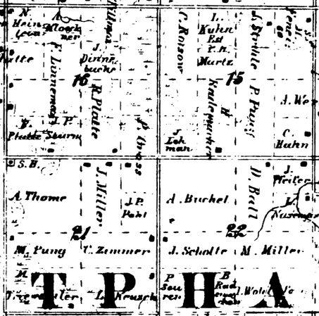
000829-02: 1864 Plat
1864
Plat of Westphalia Township, Clinton, Michigan, 1864, showing land owned by Heinrich Rademacher [00568] in Section 15 (80 acres). This parcel is consistent with two 40 acre parcels awarded by federal land patents (000816 and 000817).
A parcel owned by "A. Buchel" in Section 22 may be that of Anton Buechel [00801].
Source: D. S. Harley, J. P. Harley, J. D. Nash, H. G. Brigham, and M. C. Wagner, Map of the Counties of Clinton and Gratiot, Michigan: From Official Records and Special Surveys (Philadelphia, Pennsylvania: Samuel Geil, 1864), Westphalia Township; digital image, Michigan GenWeb, MIGenWeb (http://www.rootsweb.com/~miclinto/ : downloaded 2 June 2000.
Citation: Mike Voisin, iSeeAncestors (https://iSeeAncestors.com/tree/groups/public/media/si-00020-i568-04.php : revised June 12, 2023), Gallery.
Revised: June 12, 2023
Copyright © 2000-2023 Mike Voisin. All rights reserved.
