John Stewart

001004-03: Map, 1817
1817
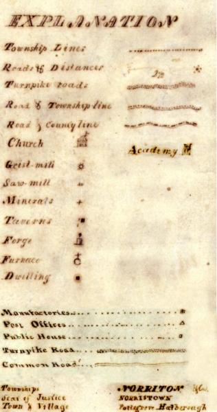
Legend for the 1817 Whiteside map, showing the symbol used to indicate a grist mill.
Source: Pennsylvania, "Melish-Whiteside Maps, 1816-1821, Record Group 17," digital images, Pennsylvania State Archives, Land Records (http://www.phmc.state.pa.us/bah/dam/rg/di/r17-534WhitesideMaps/r017-534WhitesideMapInterface.htm : downloaded 2 December 2010), Legend of map symbols; Pennsylvania Historical and Museum Commission, Bureau of Archives and History.
Citation: Mike Voisin, iSeeAncestors (https://iSeeAncestors.com/tree/groups/public/media/si-00048-i249-09.php : revised June 12, 2023), Gallery.
Revised: June 12, 2023
Copyright © 2000-2023 Mike Voisin. All rights reserved.
Source: Mike Voisin Website: https://iSeeAncestors.com E-Mail: MikeVoisin@iSeeAncestors.com
