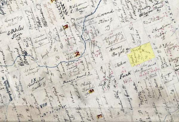
002028-01: 1844 Plat Map
23 April 1844
A map from 1844 shows the eastern section of Wellesley Township, Waterloo County, Ontario. The patriarch Peter Joseph "Joseph" Voisin (1807-1892) owned land in Concessions VIII and IX. Here he is listed as "Joseph Weison,” which is probably spelled the way it sounded to the clerk. Although the map was drawn in 1843 and published in 1844, there is no indication when the various properties were identified. Other evidence shows Joseph Voisin obtained patents for this land in 1856.
Wellesley Township, Waterloo County, Ontario, Canada
Source: Archives of Ontario, Ministry of Government and Consumer Services (http://www.archives.gov.on.ca/en/access/our_collection.aspx : Viewed 2 November 2017), "Digitized Patents Plans," Wellesley Township, Digital Image Number I0051527.jpg, Item Reference Code RG 1-100-0-0-4129, dated 23 April 1844 (http://ao.minisisinc.com/FS_IMAGES/I0051527.jpg).
Citation: Mike Voisin, iSeeAncestors (https://iSeeAncestors.com/tree/groups/public/media/si-f25591-i688-04.php : revised June 12, 2023), Gallery.
Revised: June 12, 2023
Copyright © 2000-2023 Mike Voisin. All rights reserved.
