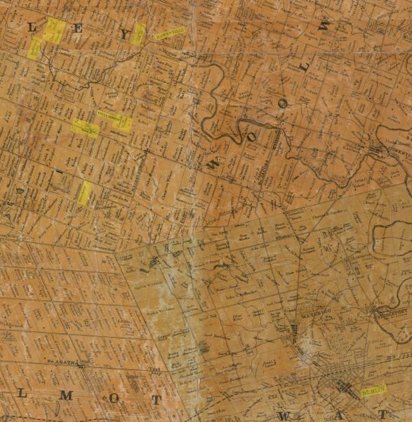
001755-01: 1861 Plat Map
1861
A map from 1861, shows villages relevant to the story of Joseph Voisin [I00021], as well as property owners. Berlin (now Kitchener) is lower right. St. Clements is nine miles northwest of Berlin, and Hawkesville is three miles north, northeast of St. Clements. (Village names on the map are slightly offset.)
The patriarch Joseph Voisin (1805-1892) owned land just east of St. Clements. Our Joseph Voisin was in Hawkesville, and also worked for an H. Otterbein in 1877, sixteen years after this map was published. Valentine Otterbein owned land south of St. Clements. He had a son Henry Otterbein, who would have been about 40 years old in 1877, when Joseph Voisin indicated he worked for H. Otterbein.
An early settler in the area, Ambrose Starr, owned land northwest of St. Clements and just west of Hawkesville. He was the father of Clements Starr, who would become a neighbor of our Joesph Voisin in Beal City, Michigan.
Waterloo County, Ontario, Canada
Source: George R. and G. M. Tremaine, “Tremaine’s Map of the County of Waterloo, Canada West,” Toronto, 1861. Ontario Historical County Maps Project: Historical Land Occupancy Information in 19th Century Ontario, Waterloo County (http://maps.library.utoronto.ca/hgis/countymaps/index.html : downloaded 1 March 2017).
Citation: Mike Voisin, iSeeAncestors (https://iSeeAncestors.com/tree/groups/public/media/si-f25592-i688-09.php : revised June 12, 2023), Gallery.
Revised: June 12, 2023
Copyright © 2000-2023 Mike Voisin. All rights reserved.
