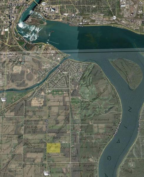
002068-08: 1876 Plat with Satellite Image
1876
A modern satellite image with an overlay of an 1876 plat map showing the precise location of land owned by Henri Joseph Voisin [I02043] and Anne Marie (Ditner) Voisin [I02175]. It was four miles from Niagara Falls, Ontario.
Willoughby Township, Welland, Ontario, Canada
Source: Google Earth Pro, with Illustrated historical atlas of the counties of Lincoln and Welland, Ont. (Toronto: H.R. Page & Co., 1876); digital image, In Search of Your Canadian Past: The Canadian County Atlas Digital Project (http://digital.library.mcgill.ca/CountyAtlas/ : Downloaded 12 December 2017), Willoughby Township, Welland County, Ontario, Joseph Wesaw.
Citation: Mike Voisin, iSeeAncestors (https://iSeeAncestors.com/tree/groups/public/media/si-00016-i2043-12.php : revised June 12, 2023), Gallery.
Revised: June 12, 2023
Copyright © 2000-2023 Mike Voisin. All rights reserved.
